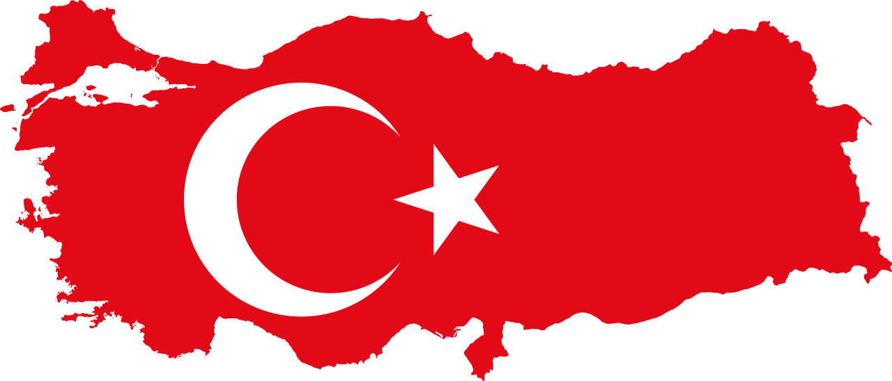
Discover the map of Turkey, its borders, its reliefs and its regions through this article.
Turkey is located in the Eastern Mediterranean, east of the Balkan Peninsula. It is a crossroads at the junction of several worlds and cultures.
Map of Turkey : Borders
To the north, the country is bordered by the Black Sea and the Caucasus which opens onto Russia. To the east, Turkey is attached to the Turkish-speaking part of Central Asia. To the south and southeast, it has common borders with Iran, Iraq and Syria. To the west, the country opens onto the Aegean Sea and the Mediterranean.
Turkey has a total area of 783,562 km², its capital is Ankara with a population of 84.34 million in 2020. It is separated into two parts by the Dardanelles straits and the Bosphorus. It is made up of a European part, Eastern Thrace (European Turkey) and Anatolia (Asian Turkey).
It is bordered by four seas and has 8,372 kilometers of coastline and 2,753 kilometers of land borders with Armenia, Azerbaijan, Iran, Iraq, Syria, Bulgaria and Georgia.
Map of Turkey : Relief
Turkey is distinguished by a fairly young and recent relief. It is located at the level of the central part of the Alpine-Himalayan arc, a set of mountain chains resulting from the junction between the African, Arabian and Indian plates and the Eurasian plate. It is a mountainous country with recurring geological phenomena.
To the north is the Pontic chain with an extension from west to east of the schistose massif of Istranca Dag. The Black Sea is dominated by mountain ranges and the Bithynian Plateau. The only two coastal plains are made up of the Kizil Irmak and Yezil Irmak deltas.
In the south of the country is the second largest mountain range: it is the Taurus which is delimited by the Gulf of Antalya (read our article => Archaeology: the location of the tomb of Saint Nicholas discovered in Turkey) and the plain of Pamphylia. The Cilician plain is dominated by the central Taurus and delimited to the east by the Amanos, a continuity of the coastal ranges of the Levant.
The Pontic chain in the North and the Taurus in the South meet in eastern Anatolia to form the Armenian knot, characterized by the volcanic cone of Ararat culminating at 5,165 meters.
To the west, the route of the Aegean Sea is formed by a series of orientation ditches and raised west-east blocks interposed between the Taurus and the Pontic chain. The Turkish relief thus takes more and more altitude from the Aegean valleys to central Anatolia, where there are a multitude of basins, ranges and isolated volcanic massifs.
Map of Turkey : Regions
Turkish territory is subdivided into seven distinct geographical regions. This division is due to the nature of Turkish geography and the natural environments characterizing it.
● The Mediterranean coast
It is a 1,075 kilometer coastline bounded to the north by the Taurus Mountains and to the south by the Mediterranean. It is one of the most beautiful regions in the world which includes several ancient sites.
● The Aegean coast
These are 2,800 km of beaches, coves and peninsulas full of ancient sites such as Bodrum (Halicarnassus), Behramkale (Assos) and Pamukkale (Hierapolis). The cities of Izmir and Kütahya are located in this region.
● The Marmara region
It is a region encompassing the entire European part of Turkey, forming a maritime corridor that separates two continents. The Sea of Marmara is connected to the Black Sea and the Aegean Sea by the Bosphorus and Dardanelles straits. It is in this region that the ancient site of Troy is located.
● The Black Sea region
This region is characterized by its immense beaches and green forests. It is the world epicenter of hazelnut production. It includes 50% of the 7,000 species of plants in Turkey. The city of Trabzon is the historical and cultural capital of the region.
● Central Anatolia
The oldest civilizations in human history originated in this region. Hattis, Galatians, Byzantines, Seljuks and Ottomans lived in this part of the country. The cultural and historical richness of this region is unique. The city of Ankara, capital of Turkey is located in the center of this region.
● Eastern Anatolia
It is the eastern part of the Anatolian plateau with the highest peak in the country, the Great Ağrı, culminating at 5,137 meters. Lake Van is also in this region.
● Southeast Anatolia
It is the region where Mount Nemrut and the city of Gaziantep are located which is characterized by its richness and culinary diversity. The town of Zeugma, located in this region, is famous for its mosaics decorating its ancient Roman residences.


Comments are closed